Using GIS
to map forest canopy and elevational data:
In February of
2005, Horizon’s Inc. flew a LIght Detection And Ranging (LiDAR) acquisition for
the Coeur d'Alene Reservation. The following images depict some of the
preliminary data products for that flight. The total project area covers
342,477 acre Coeur d’Alene Reservation.
The Tribe acquired the raw LiDAR data and processed it using
tools developed by the USDA Forest Service, Rocky Mountain Research Station in
Moscow, Idaho.
The following images depict some of the preliminary data products for the LiDAR
processing. The imagery found on this web site has been reduced in resolution
to make images smaller for web viewing. The data depicted here is from the
Benewah Creek Valley on the Coeur d'Alene Reservation.
Figure 1. Map of test area, with roads, streams and color orthophoto.
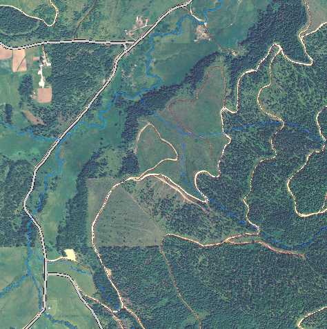
Figure 2. Hillshade created from Digital Terrain Model made from LiDAR,
including vegetation.
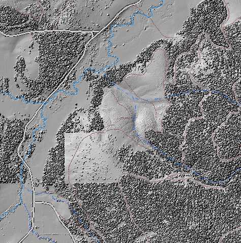
Figure 3. Hillshade created from Digital Terrain Model made from LiDAR,
excluding vegetation. (Bare earth hillshade)
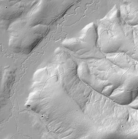
Figure 4. Hillshade overlaid with vegetation heights. Coloring is in steps of
5-meter increments.
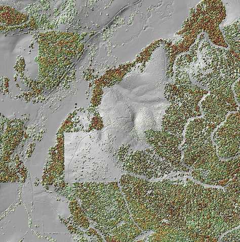
Figure 5. LiDAR intensity values. (The intensity value is a measure of the
return signal strength.)
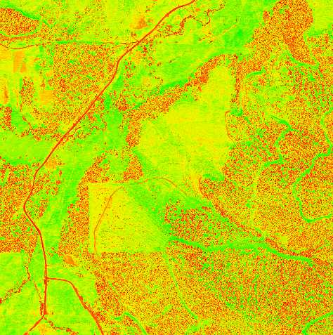
Figure 6. Hillshade created from Digital Terrain Model made from LiDAR, overlaid
with Color Ortho Photo.
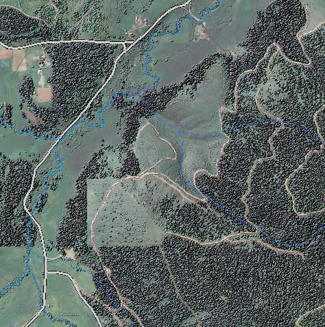
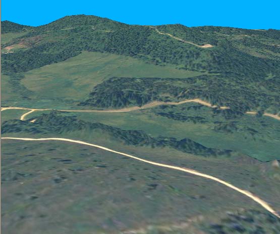
Figure 7. Three-dimensional view of project area using LiDAR as elevational
model and then overlaying that with color digital ortho photo using ArcGlobe.
 For more
information about the study please contact
GIS Manager
For more
information about the study please contact
GIS Manager