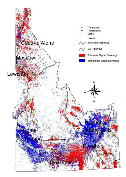
Using GIS to evaluate the
next generation of Idaho Public Television:
Idaho
Public Television contracted the Tribe’s GIS office services to evaluate the
number of individuals in the State of Idaho that could be served by Digital
Television. The GIS was used to create individual signal coverage areas for
each of Idaho Public Television’s transmitters and translators. The signal
coverage GIS layers were then combined with US Bureau of Census data to
calculate the number of people that could potentially receive the signal.
Map of Potential Digital Television Signal Coverage.