UAS (Unmanned Aerial Systems) Program
Our goal is to supplement our future maintenance and upgrade costs for all UAS’s and associated equipment.
*All flights will vary per project requirements
Program requesting flight:
The location of the area to be flown:
*Please attach parcel image and/or parcel ID indicating the extent of the flight.
Approximate size of area to be flown:
Acres:
UAS to be used:
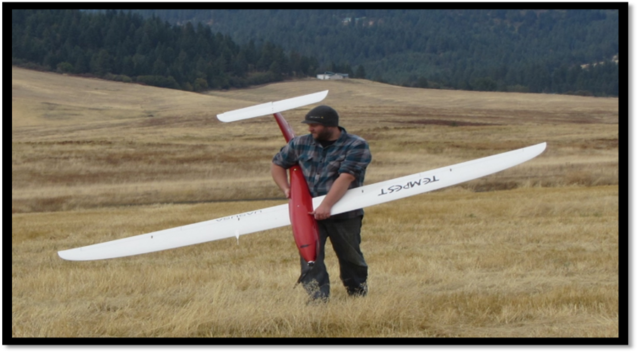
Tempest (fixed-wing, long-range)
X8 (Fixed-wing, short-range, future sensor mount coming)
DJI M600 (rotary-wing, very short-range)
Sensors to be used:
Sony A6000 (RGB orthoimagery, DEM, DSM, 3D point-cloud)
MicaSence Red Edge (Near-infrared, NDVI)
Headwall Hyperspec Nano (Hyperspectral)
Time Frame:
Will more flights need to be done (leaf on/ leaf off)? Describe:
Deliverable:
Portal for ArcGIS
ArcSDE geodatabase
Map (paper)
Additional custom image analysis. Specify:
Pricing is based on following:
Site visit = 8 hours (2-3 persons):
To include visiting the site acquiring keys or pin codes, establishing high-precision GPS Ground Control point locations, parking, take off/landing locations, alternate wind change location and whether or not the site needs to be broken into multiple flight segments.
Field equipment preparation = 1 hour (1 person, GIS Analyst):
To include charging batteries, going through airframe checklist, weather checking, packaging and vehicle loading.
Flight path creation = 1 hour (2 persons, Technician and Senior Analyst):
To include creation of take-off and landing, and alternate takeoff and landing (wind change) flight paths and the expected image acquisition flight paths. Sensor(s) to be used will affect lane width and height at which the UAS flies (max 400ft). Insure there are appropriate lead-in and exit distances, and adequate (60% minimum) front and side overlap.
Flight day = 8 hours (3 persons, all field personnel):
To include loading vehicle (if not done during the preparation phase) and driving to location. Unpack and set up all equipment, go through flight check for each flight. Flight safety pilot and command center radio communication, air traffic and weather monitoring. Recovery checklist clean up, pack and travel back. Clean and unpack UAV equipment, recover flight logs from autopilot and data from memory cards, check batteries for long term storage if needed.
Post processing 4-6 hours (2 persons):
To include memory card data (imagery) and flight log to be placed in Drone2map workstation folder. Start processing and monitor. Backup imagery check analysis, rerun if necessary. Share Imagery to Portal for web map and app creation (deliverable) or place on server for future access.
Flight time staff costs:
Senior GIS Analyst $100 per hour
GIS Analyst $75 per hour
GIS Technician $60 per hour
Travel (from Plummer GIS Department to location and back to Plummer office):
$0.535 per mile
Processing maintenance Fee:
Work Station $7,000.00
Software (Drone2map) $1,500.00 per year subscription
Total $8,500.00 / 40 flights per year $212.50/flight
Processing adjusted for sensor:
Sony $250.00
MicaSense $300.00
Tempest maintenance:
Electric Flight Motor, Neumotor 1509 series $300.00
Speed Controller $110.00
Switching Regulator $40.00
Folding Propeller $18.00
Wing Servo $ 50.00
Digital Telemetry Servos $150.00
LiPo 11,000 5S 18.5 V Battery $350.00
Total $ 1,018.00 / 40 flights per year = $25.45/flight
Sensor maintenance:
Sony A600 $600.00
Sony E20mm F2.8 Lens $350.00
Total $950.00 / 40 flights per year = $23.75/flight
Mica Sense $5,000.00 /40 flights per year = $125.00/flight
UAV Flights and Data Processing